Stan Amster Photography – Scenic and Commercial Photography in Northern New England.

Travel

The Old Dairy Barn at Shelburne Farms in Shelburne Vermont

Shelburne-Farms-7-15-2016-25
This may be the last known picture of the barn. Sadly, on Sept. 11, 2016, lightning from the storm struck the Old Dairy Barn and it burned to the ground.

At about 5:30am, on Sept. 11, 2016, lightning from a Thunderstorm struck the Old Dairy Barn on the Southern Acres portion of the property. First responders and firefighters arrived on the scene slightly after 7am. By 9:30am, the building was ash and charred wood, and a National Historic Landmark had been lost.

The Old Dairy Barn at Shelburne Farms in Shelburne Vermont Read More »

Power House Covered Bridge in in Johnson Vermont

VT-6-9-2013-69

The Power House Covered Bridge, also known as the School Street Covered Bridge, is a covered bridge from 1872 that crosses the Gihon River off State Route 100C in Johnson, Vermont, US. It was listed on the National Register of Historic Places in 1974. The bridge’s name is from a now obsolete hydroelectric generating station just upstream from it. The bridge is of Queen post truss design by an unknown builder.

The Power House Covered Bridge is located east of the village of Johnson, on School Street just west of Vermont Route 100C. It cross the Gihon River, a tributary of the Lamoille River in a roughly east–west orientation. It is a single-span Queen post truss structure, 63.5 feet (19.4 m) long and 19 feet (5.8 m), with a roadway width of 16 feet (4.9 m) (one lane). The bridge rests on stone abutments faced in concrete, and is covered by a gabled metal roof. The exterior is clad in vertical board siding, which extends around to the insides of the portals. On the sides, the siding does not extend all the way to the roof, leaving an open strip. The trusses include iron rods for stability, and have had metal plates added to some of the joints for increased strength.

Power House Covered Bridge in in Johnson Vermont Read More »

Middlebury Falls in Middlebury Vermont

Middlebury-Falls-Middlebury-VT-8-30-3019-7-Edit-Edit
Middlebury Falls is an impressively broad waterfall along Otter Creek located in downtown Middlebury Vermont. The falls plunge only 18 feet over an undercut shelf, but stretch 170 feet across and during periods of higher flow the river will overwhelm the entire cliff face, while during the summer and early autumn months it may segment into two or three distinct channels. Remnants of a small millrace on the right side of the falls are also visible, with a small portion of the creek being diverted through, though not nearly enough to impact the volume of water actually flowing over the falls.


Despite being an urban waterfall, found right in the center of the town of Middlebury, the development around the falls doesn’t detract from the scene quite as much as one might otherwise assume at first glance, and the city has done a great job at both embracing the falls and providing multiple public open spaces with views of the falls. A long metal footbridge spans Otter Creek downstream from the falls and provides interesting views through a grove of trees adjacent to the old mill race, and a nice park with ample open space on the north side of the stream allows for airy, unobstructed views of the whole falls.

Middlebury Falls in Middlebury Vermont Read More »

A foggy summer day at Portland Head Lighthouse in Cape Elizabeth, Maine

Portland-Head-Light-6-27-2019-34
Portland Head Light is a historic lighthouse in Cape Elizabeth, Maine. The light station sits on a head of land at the entrance of the primary shipping channel into Portland Harbor, which is within Casco Bay in the Gulf of Maine. Completed in 1791, it is the oldest lighthouse in Maine. The light station is automated, and the tower, beacon, and foghorn are maintained by the United States Coast Guard, while the former lighthouse keepers’ house is a maritime museum within Fort Williams Park.

A foggy summer day at Portland Head Lighthouse in Cape Elizabeth, Maine Read More »

Sawyers Crossing Covered Bridge in Swanzey New Hampshire

Cresson-Covered-Bridge-Swanzey-6-15-2019-15
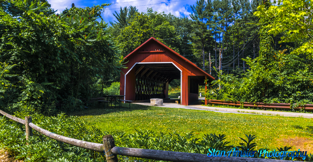
The Sawyers Crossing Covered Bridge, also known as the Cresson Bridge, is a wooden covered bridge carrying Sawyers Crossing Road over the Ashuelot River in northern Swanzey, New Hampshire. Built in 1859 to replace an older bridge, it continues to serve as a part of Swanzey’s transportation network, and is one of the state’s few surviving 19th-century covered bridges. It was listed on the National Register of Historic Places in 1978.

Sawyers Crossing Covered Bridge in Swanzey New Hampshire Read More »

West Quoddy Head Lighthouse in Lubec, Maine.

West-Quody-lighthouse-10-10-2014-34
West Quoddy Head is an easterly-pointing peninsula in southeastern Lubec, overlooking Quoddy Narrows, a strait between Lubec and Campobello Island, Canada, that provides access to Passamaquoddy Bay and harbors located on the St. Croix River and other rivers which the empty into the bay. Most of the peninsula is part of Quoddy Head State Park, and the light station is located near the southern end of its eastern face.

A stone sign describes the lighthouse as the “easternmost point in the U.S.A.” It is the easternmost building in the United States (a nearby sign proclaims the “easternmost giftshop in the U.S.”), but the easternmost point is at rocks extending eastward from the shoreThe present light station includes a tower, former keeper’s quarters, service building, and oil house. The tower is circular, and is 49 feet (15 m) in height, with the beacon at 83 feet (25 m) above sea level. The light, magnified by a third-order Fresnel lens, has a range of 18 miles (29 km). The tower is built of brick, and painted in alternating horizontal red and white stripes. A small gabled entry vestibule, also brick, projects from the tower. The keeper’s house is a wood frame structure, 1​1⁄2 stories in height.

West Quoddy Head Lighthouse in Lubec, Maine. Read More »